
rom Wikipedia, the free encyclopedia
| United Republic of Tanzania
Jamhuri ya Muungano wa Tanzania (Swahili)
| ||||||
|---|---|---|---|---|---|---|
| ||||||
| Motto: "Uhuru na Umoja" (Swahili) "Freedom and Unity" | ||||||
| Anthem: Mungu ibariki Afrika (Swahili) God Bless Africa | ||||||
|
| ||||||
| Capital | Dodoma | |||||
| Largest city | Dar es Salaam | |||||
| Official languages |
| |||||
| Demonym | Tanzanian | |||||
| Government | Unitary presidentialconstitutional republic | |||||
| - | President | Jakaya Kikwete | ||||
| - | Prime Minister | Mizengo Pinda | ||||
| Legislature | National Assembly | |||||
| Independence from the United Kingdom | ||||||
| - | Tanganyika | 9 December 1961 | ||||
| - | Zanzibar and Pemba | 10 December 1963 | ||||
| - | Merger | 26 April 1964 | ||||
| - | Current constitution | 25 April 1977 | ||||
| Area | ||||||
| - | Total | 945,203 km2 (31) 364,898 sq mi | ||||
| - | Water (%) | 6.2 | ||||
| Population | ||||||
| - | 2012 census | 44,928,923[1] | ||||
| - | Density | 47.5/km2 123.1/sq mi | ||||
| GDP (PPP) | 2012 estimate | |||||
| - | Total | $73.859 billion[2] (81) | ||||
| - | Per capita | $1,566[2]b | ||||
| GDP (nominal) | 2012 estimate | |||||
| - | Total | $28.247 billion[2] | ||||
| - | Per capita | $599[2]b | ||||
| Gini (2007) | 37.6[3] medium | |||||
| HDI (2012) | low · 152 | |||||
| Currency | Tanzanian shilling(TZS) | |||||
| Time zone | EAT (UTC+3) | |||||
| - | Summer (DST) | not observed (UTC+3) | ||||
| Drives on the | left | |||||
| Calling code | +255c | |||||
| ISO 3166 code | TZ | |||||
| Internet TLD | .tz | |||||
| a. | In higher education and the higher courts.[5] | |||||
| b. | Based on a 2006 population estimate for 2012 of 47.1 million instead of the 2012 census result of 44.9 million. | |||||
| c. | +007 from Kenya and Uganda. | |||||
| Population estimates for this country explicitly take into account the effects of excess mortality due to AIDS; this can result in lower life expectancy, higher infant mortality and death rates, lower population and growth rates, and changes in the distribution of population by age and sex than would otherwise be expected. | ||||||
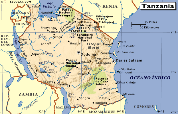
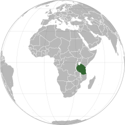
Tanzania /ˌtænzəˈniːə/, officially the United Republic of Tanzania (Swahili: Jamhuri ya Muungano wa Tanzania),[6] is a country in East Africa. It is bordered by Kenya and Uganda to the north; Rwanda, Burundi, and the Democratic Republic of the Congo to the west; and Zambia, Malawi, and Mozambique to the south. The country's eastern border is formed by the Indian Ocean. Kilimanjaro, Africa's highest mountain, is in northeastern Tanzania.
The country is divided into 30 administrative regions: five on the semi-autonomous islands of Zanzibar and 25 on the mainland in the former Tanganyika.[7] The head of state is President Jakaya Mrisho Kikwete, elected in 2005. Since 1996, the official capital of Tanzania has been Dodoma, where the National Assembly and some government offices are located.[8] Between independence and 1996, the main coastal city of Dar es Salaam served as the country's political capital. It remains Tanzania's principal commercial city and is the main location of most government institutions.[7][9] It is also the principal port of the country.[10]
The name "Tanzania" derives from the names of the two states, Tanganyika and Zanzibar, that united on 26 April 1964 to form the United Republic of Tanganyika and Zanzibar.[7] On 29 October 1964, the country was renamed the United Republic of Tanzania.[7] The Articles of Union are the main foundation of Tanzania.


